Or don't you tend to bother? I ask because I have had a stab at making one myself, using none other than Open Office's version of Microsoft Powerpoint.
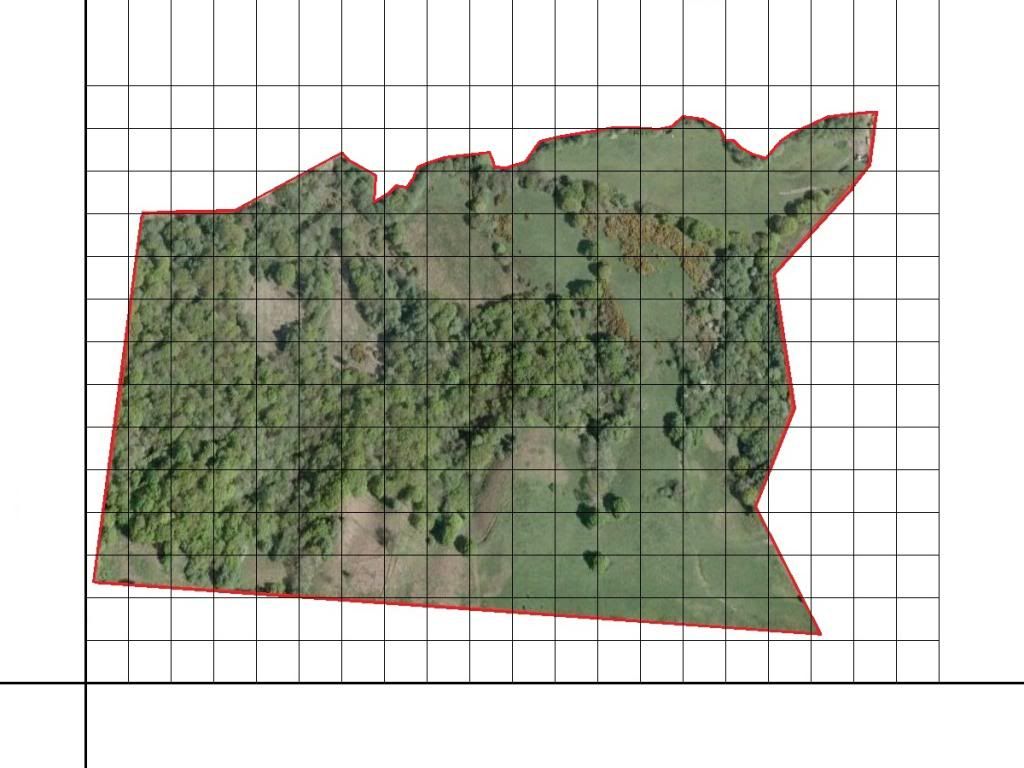
I have used First and Only's Anzio Camp for it, on there forum there is a pre-existing map, but its rather bland and doesn't use any aerial imagery or anything of the sort. Aerial Imagery is widely available these days (Google, Bing) and truth be told, I make a living out of producing maps for the Military (make of that what you will).
So, I am just looking for a bit of feedback with this, on Maps and Nav in general and my personal OpenOffice attempt. I should make it known that I don't use OpenOffice at work, we have software designed for Map production.
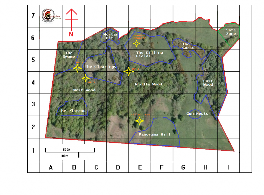
Instead of a standard BNG Grid (OS Map style) or MGRS or what have you, I have gone for a much more simplistic Grid system, so that literally anyone can give a "coordinate". The grid squares are 30m by 30m (Using the Scale Bar off the bottom right of Bing Maps to measure 30m. I appreciate I could have done 10's, or 50's, or any other rounder number, but by the time I had realised and sorted it all out I wasn't going to change it, not for a test run at least.
Anyway, feedback definitely appreciated. I should also mention it has been produced at Page Size A5, so ideal for a leg pocket or Nirex Folder, or wherever you might choose to keep it. I also haven't printed one of these off yet, so I can't say what a hard copy might look like, and of course it depends on Colour printer availability!
Cheers all,
Liam
I have used First and Only's Anzio Camp for it, on there forum there is a pre-existing map, but its rather bland and doesn't use any aerial imagery or anything of the sort. Aerial Imagery is widely available these days (Google, Bing) and truth be told, I make a living out of producing maps for the Military (make of that what you will).
So, I am just looking for a bit of feedback with this, on Maps and Nav in general and my personal OpenOffice attempt. I should make it known that I don't use OpenOffice at work, we have software designed for Map production.
Instead of a standard BNG Grid (OS Map style) or MGRS or what have you, I have gone for a much more simplistic Grid system, so that literally anyone can give a "coordinate". The grid squares are 30m by 30m (Using the Scale Bar off the bottom right of Bing Maps to measure 30m. I appreciate I could have done 10's, or 50's, or any other rounder number, but by the time I had realised and sorted it all out I wasn't going to change it, not for a test run at least.
Anyway, feedback definitely appreciated. I should also mention it has been produced at Page Size A5, so ideal for a leg pocket or Nirex Folder, or wherever you might choose to keep it. I also haven't printed one of these off yet, so I can't say what a hard copy might look like, and of course it depends on Colour printer availability!
Cheers all,
Liam
Last edited by a moderator:
")

 ) cause when a regular finds a good position they usually aim to reuse it... also the sites style of play changes seasonally, id the 'ditches,trench' is avoided in winter when they are full of water but are brilliant at this time of year, tall grases making some areas better etc... (ie if yo're useing one make sure its up to date...

")